i.7. THE CONTEXT WITHIN WHICH THESE EVENTS OCCURRED

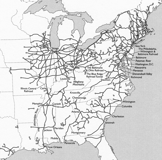
What I have attempted in this blog is to set the history of Chicago and its architecture of this period within its historical context.  To truly understand and appreciate what an architect was trying to do in the design of a building, it is essential to know the surrounding physical context of the building’s site: which direction is south, what types of streets border it, and what existing buildings are immediate adjacent to it.  A building’s “context,” however, is broader than just its site, as it includes the efforts of all of the people involved and the corresponding forces, decisions, and pressures addressed, and many times overcome, in the creation of the building.  In the previous three paragraphs I purposefully referenced some of the leading European architectural theorists of the era without introducing them.  These were the leading writers of modern architectural theory at the time, whose books were read, studied, and discussed by architects in Europe and the U.S., including Chicago.  Chicago was not an island onto itself, isolated at the edge of civilization from any influence from developments or buildings in other cities or countries: it was intimately linked to the rest of the country by the telegraph and railroad.  Within the short span of twenty-three years after its founding in 1833, Chicago had gone from being on the fringe of civilization, to being the center of American Midwestern civilization in 1856 as it became the hub of the largest network of tracks in the world.

Map of American Railroads and major junctions in 1861. (Thomas, The Iron Way)

The development of a city is no different from that of its architecture.  Chicago did not grow in a vacuum; it was impacted by seemingly unrelated events that sometimes took place in remote locations.  This was the context in which Chicago and its architecture evolved, and therefore, to get a clear and thorough understanding of the development of the city, including its architecture, one should examine the context in all its relevant aspects in which these events unfolded.  For me, context is everything.  In my forty-plus years of teaching architectural history at the University of Cincinnati to majors and non-majors alike, I found that not only introducing students to the topic, but also by placing the topic within its context, be that the historical, economic, social, political, geographic, or artistic context, at the regional, national, or international scale, gave a student a fuller understanding and appreciation for the topic.  This is what I have attempted to do in this blog.  I also recognize that a large portion of my audience is not intimate with many of the details of history that I need to refer to in telling this story.  Therefore, I found it important to include sections that included events, people, and buildings from cities beyond Chicago and to summarize topics beyond those that directly relate to Chicago that I believe a reader needs to know in order to better comprehend a particular topic’s context.  For those who already know the history of any of these topics that I have included, such as Napoleon III’s urban renewal of Paris or the British Design Reform movement, they can simply skip over the posts so dedicated if one wishes.  But those who are not familiar with such topics will find their understanding of the topic to be richer for having been introduced to the contextual information.

Gustave Caillebotte, Paris Street; Rainy Day, 1877. A view of the reconstructed Paris accomplished by Napoléon III and Haussmann. (Art Institute of Chicago)

The four most important cities that played pivotal roles in Chicago’s historical, urban, and architectural development, that one cannot ignore if one wants to truly understand the Chicago phenomenon were Paris, London, Cincinnati, and New York.  During the Second Empire of Napoléon III, Paris, la ville lumiére, had become the most important city in the world for both its architecture and its urban design, as the Emperor had embarked upon a twenty-plus year campaign to bring his capital into the technological nineteenth century.  No less than French novelist, Victor Hugo, no fan of the Emperor by the way, sang the city’s praise best:

“It is in Paris that the beating of Europe’s heart is felt.  Paris is the city of cities.  Paris is the city of men.  There has been an Athens, there has been a Rome, and there is a Paris…

Napoléon III’s Paris was the model city for almost everyone who wanted to build a beautiful city in the later half of the nineteenth century.  As we will see, there was a curious parallel in the chronology of events between the rise of the Second Empire of Napoléon III and the rise of Chicago (let’s not forget that the first European explorers of the Chicago area who laid claim to the region were French), starting with the timing of Louis Napoléon’s rise in French politics during the summer and fall of 1848, when he won the highest number of the votes cast for the National Assembly on September 17-8, that led to his victory in the Presidential election some three months later on December 10-11.  As Louis Napoléon had spent the summer of 1848 laying the foundation for his eventual political success, William Ogden had spent that same summer laying the first tracks for the Galena & Chicago Union railroad (that would ultimately bring the transcontinental railroad to Chicago), with its first official run of eight miles having taken place on Nov. 20, only twenty days before Louis Napoléon was elected President.  Meanwhile, at the end of this blog’s timeframe, one cannot fully comprehend the fear personally felt by Chicago’s “leading citizens” following the city’s destruction by the 1871 fire without understanding that some of Paris’ most important buildings had been destroyed only four and a half months earlier by fires purposefully set by members of the Parisian Commune (Communards) and that over 20,000 Parisians had been killed, as the army of the Nationalist government crushed their three-month long revolt and regained control of the city during the week of May 21-28, 1871.

Charles Barry and Augustus Pugin, House of Parliament, London, 1835. (Online)

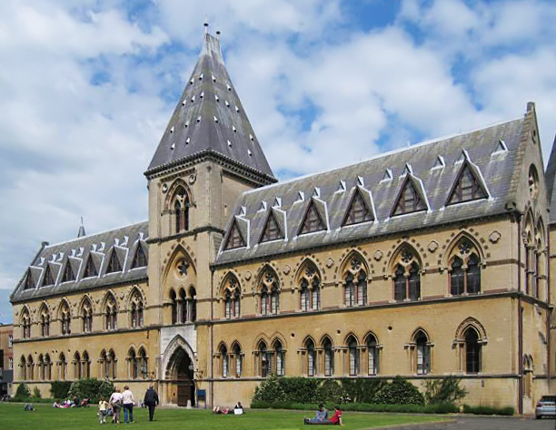
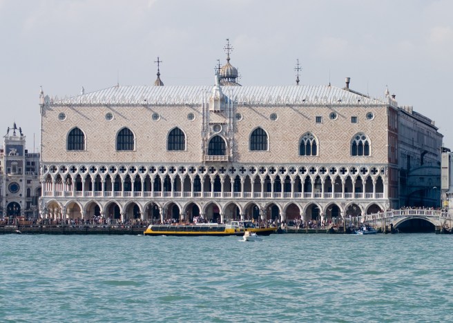
London at this time offered an artistic alternative in European design theory to that of Paris.  So much so, in fact, that it will become quite evident to the reader that American architecture will be pulled between these two primary European poles of design theory during the second half of the nineteenth century.  The battle within American architecture during this era was waged between those who championed the academic Neo-Baroque eclectic architecture of the Second Empire, and the few, but growing number of individuals who were influenced by the rising tide of innovative design initiated by the British writers Jones, Pugin, and Ruskin.  It was of no little consequence that the most important buildings under construction in Europe between 1848 and 1871 that were most emulated by American architects were the Tuileries/Louvre complex and the Opera House in Paris, the Oxford Museum and the Midland Hotel/St. Pancras Station in London, and, of course, the Doge’s Palace in Venice that Ruskin had posited as “the central building of the world.”

Doge’s Palace, Venice, 1340-1442. (Online)

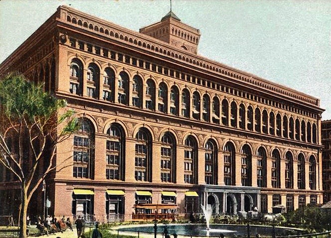
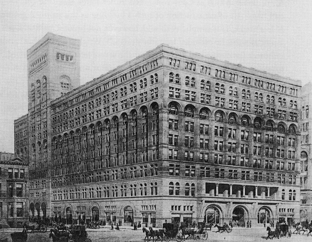
When Chicago was chartered as a town on Aug. 5, 1833, it had little in the way of indigenous cultural traditions and institutions, including architecture.  When it was eventually ready to invest in these, Chicago naturally looked eastward for inspiration and precedents.  The closest competition that Chicago had to overcome was that of Cincinnati, the “Queen City of the West.”  Having had a forty-five year head start, Cincinnati had already moved beyond mere survival and into the cultural phase of urban development before Chicago had even been chartered as a city in 1837.  As the two cities were basically in the same geographic region, it was Cincinnati, and not New York City, as is so often presumed to have been the case, that provided Chicago with models for it to first emulate when it was finally interested and financially able, and then to surpass those of its older and more established Midwestern competitor.  But once Chicago had equaled Cincinnati, it then set its sights on New York City, the most important American city in regard to mid-century architecture.  As New York was the largest city by population and economic importance in the U.S., it simply follows that New York’s architecture (especially that designed by George Post), modeled often, but not solely after Paris and London, would play a leading role within the country, even in Chicago. 

i.8. SUMMARY

 I have chronologically organized this study into five parts: 

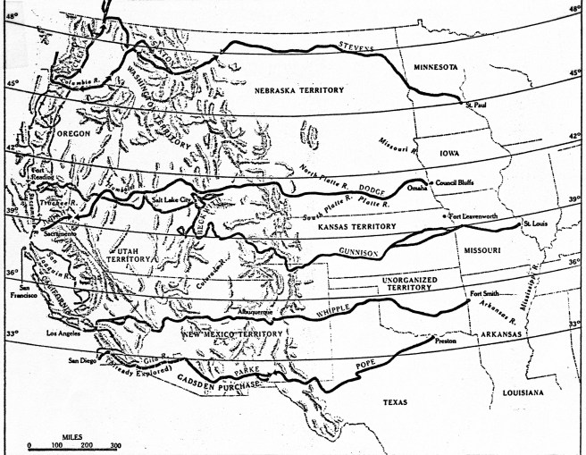
1. the period from the first French claim on “Louisiana” that included the Chicago River in 1671 to the completion of the Illinois & Michigan Canal in 1848;

2. the period from when William Ogden began construction of the Galena & Chicago Union Railroad in 1848 to the financial panic of 1857, during which time Chicago became the hub of the world’s largest railroad network;

3. the period that included the build-up to the American Civil War and the war that discusses its impact on Chicago; 

4. the immediate post-war period up to the fire of October 8, 1871, in which occurred the construction of the first transcontinental railroad when Chicago, correspondingly became the largest and central city of the West, and;

5. the post-fire reconstruction between the 1871 fire and the July 14, 1874 fire, the result of which was the cancellation of all fire insurance policies by Nov 1, 1874, that finally instigated the eventual improvement of Chicago’s construction practices that occurred during the Chicago School of the 1880s.

(If you have any questions or suggestions, please feel free to eMail me at: thearchitectureprofessor@gmail.com)

i.5. THE RAILROAD

Surveyed Routes for the Transcontinental Railroad.  In March 1853, Congress appropriated $150,000 to survey four possible routes.  Those are shown with the names of the surveyor in charge.  The actual route used with the Act of 1862, however, started from Council Bluffs/Omaha and was surveyed by Grenville Dodge. It was not even considered in the 1853 survey, but is included on this map.  (Time-Life, Old West Railroads)

The recession of 1837-45 had slowed the construction of the Illinois & Michigan canal as well as economic migration in the West that allowed Cincinnati to maintain its central position as the largest city in the NorthWest.  St. Louis, however, due to its natural geographic advantages was destined to eventually overtake Cincinnati as the country continued to grow ever westward, and it finally celebrated, along with Chicago, the completion of the canal in 1848.  It was at this precise moment, however, that the technology of the nineteenth century had coalesced to produce the railroad that gave humans the power to overcome the nature-made advantages as well as the limits of geography.  Therefore, the western city that would win this new competition set into motion by the introduction of the railroad into the American landscape, would dictate the resulting growth in the region.  The most important political decision that would determine which western city would come out of top was where would the first transcontinental railroad be located, for over this route would eventually flow the vast majority of goods and people between the Atlantic and Pacific Oceans.  In essence, the winner would become the capital of the interior of the United States, that is, the political, economic, and cultural center between the Atlantic and Pacific coasts.

The antebellum transcontinental railroad could have, and probably should have been built, for any number of reasons on a route that paralleled the Mason-Dixon Line from Baltimore to Cincinnati to St. Louis and westward (a second “Missouri Compromise,” if you will), that would have assured St. Louis’s future as the capital of the West.  The smaller cities of Chicago in the north and Memphis in the south would eventually have been connected via branch lines to this trunk line.  But antebellum Sectional jealousies in Congress as well as Luddite-like responses by some to the threat posed by this new-fangled technology to existing investments and businesses, especially those of the river steamboat industry, protracted the Federal decision on the transcontinental railroad for over two decades, until the start of the Civil War removed Southern obstructionists from the decision process while imposing a crisis upon the Northern Congress that forced it to finally make a decision.  A decision that was not to the advantage of Cincinnati and St. Louis, for the competition would eventually be won by Chicago, not through any preordained geographic advantage, but through the hard-fought efforts of its citizens and those who had financial investments in the outcome of the competition, and with a little help from history.  Hindsight reveals that every antebellum setback to the start of the construction of a compromise transcontinental route through the country’s midsection (i.e., Washington, D.C., Cincinnati, and St. Louis) prior to 1856 (the completion of the Illinois Central) was another victory for Chicago in its campaign to eventually become the dominant city in the West.  To the credit of Chicago’s leading patrician, William Ogden, and Illinois’ Senator Stephen A. Douglas, the actual route of the first transcontinental railroad would eventually be located some 200 miles north of St. Louis to Chicago, making Chicago, and not St. Louis, the eventual nexus of the West’s water and railroad systems.  (One could say that Congress’ decision actually reversed the “strategic” flow of the Chicago River some six years before the city reversed its actually flow.)

Map of Ogden’s consolidated routes of the new Chicago & Northwestern Railroad, 1864. At the time, it was the longest rail system in the country. (Harpster, Ogden)

For it was in 1848, the same year in which the canal was completed, that Ogden started construction of Chicago’s first railroad, the Galena & Chicago Union, headed not to the east to link up with the routes being built to the West but to the west to his ultimate objective, the Pacific Ocean. (I believe that historians have underestimated the importance of Ogden’s unilateral decision:: there were no railroads to Chicago in 1848, period. Ogden started his without any assurances that an Eastern railroad would build to Chicago.) He had gambled that the eastern railroads would want to lay tracks north to Chicago once they reached the southern tip of Lake Michigan to connect with his track, rather than simply laying tracks from the mouth of the Calumet River, some thirty miles to the south of the village of Chicago, west straight to Rock Island on the Mississippi.  It would be more than three long years after Ogden had started laying tracks, however, before the first railroad from the Atlantic coast finally made a connection to Chicago in late 1851. But once Chicago was connected to the East coast, it then took only five more years to lay the world’s largest railroad network with Chicago as its hub, with some 58 passenger trains and 38 freight trains arriving/departing daily in 1856 along a network with over 3000 miles of track.  Chicago’s population had expanded to 86,000 by this date, making it the fourth largest city west of the Allegheny Mountains (then New Orleans was still the largest with 140,000, Cincinnati was second with 135,000 and St. Louis was third with 90,000).  All three Northern cities continued to gain in population during the Civil War, but after Congress finally decided in 1862 that the Union Pacific should start in Omaha, NE, in a direct line with Chicago, Chicago’s population grew the fastest, finally surpassing Cincinnati’s in 1868.  Meanwhile St. Louis had already surpassed Cincinnati during the war to become the largest city in the West, a title it held until Chicago’s population finally surpassed St. Louis’, but this didn’t occur until after the transcontinental railroad was completed in 1869 and was in operation for a number of years.

Map of American Railroads and major junctions in 1861. (Thomas, The Iron Way)

Railroad construction in Chicago from its inception in 1848 to the 1871 fire was primarily financed not by Chicago capital (there was precious little of that during the city’s infancy), but first by East Coast and European venture capital and then with the infusion of Federal funding through landgrants such as that secured by Sen. Douglas’ tireless campaign to build the Illinois Central Railroad.  Railroads not only directly affected the physical structure of the city, especially in regard to the location of the required stations, but also indirectly influenced how the city grew, as developers sought to erect their buildings within the close physical proximity to these new urban activity centers.  Therefore, in order to truly understand and appreciate the accomplishment of the construction of Chicago’s rail network that would lead to its premiere position in the West, as well as the railroads’ impact on the physical development of the city’s business district, one needs to understand who was actually funding the construction of the railroads, as well as why and where these businessmen were building their lines and stations.

(If you have any questions or suggestions, please feel free to eMail me at: thearchitectureprofessor@gmail.com)

i.6. ARCHITECTURE

John M. Van Odsel, Courthouse Square bounded by Clark, Washington, La Salle, and Randolph (looking north). The additional floor and a larger cupola had been added in 1858. Photograph taken on May 2, 1865, with the Courthouse decorated in mourning following the assassination of Abraham Lincoln. The line of mourners to view Lincoln’s casket flows down the stairs. (Lewis, Remembering Chicago)

So it was the route of the first transcontinental railroad that finally allowed Chicago to pull to the forefront of Western cities shortly after the 1871 fire.  But what was Chicago’s architecture like just prior to the Great Fire?  Books abound that document the Chicago that arose out of the ashes of the fire.  Some make assumptions of what the pre-fire city looked like or how the fire affected the reconstruction of the post-fire city, but there is no comprehensive study of the Chicago that was actually destroyed or of how the fire subsequently affected construction practices immediately after.  This blog is an attempt not only to do just that, to document the Chicago that burned on October 8, 1871, but to better appreciate how the city’s urban structure had developed by that date: to also record how the city evolved in just 41 years from a virgin marsh within the Illinois prairie when Thompson surveyed it in 1830 into a city of 325,000 inhabitants by 1871.

When one mentions “Chicago architecture,” one cannot avoid the associations it has with three somewhat independent yet interdependent topics: modern architecture, the skyscraper, and the iron skeleton frame.  While these internationally studied topics did not enjoy their first period of maturation until the 1880s, that is obviously beyond the scope of this study’s timeframe (see my other blog documenting the Chicago School – click icon at right), the foundations for the development of all three had been laid prior to October 1871, albeit not, by any means, solely in Chicago.   I will document many of the events, issues, and personalities involved with the development of each of these three topics that occurred throughout the U.S. and Western Europe during the timeframe of this blog, to present a broader picture of how they developed, and ultimately manifested themselves in Chicago’s post-fire architecture.

Left: John Mills Van Osdel (1811-91); Right: W. W. Buffington (1818-98)

While the work of Chicago’s first architect, John Mills Van Osdel, has been well documented and he has been celebrated as having been the city’s leading architect prior to the 1871 fire, there are three other major figures in the history of Chicago’s architecture during this era whose seminal importance have not been fully documented.  William Warren Boyington, an experienced professional from Massachusetts who moved to Chicago in 1853, is one of these whose impact on the city’s fabric and skyline has been grossly marginalized simply because he produced the great majority of his many and monumental buildings during the period prior to 1885 when eclecticism was not only the fashionable style of architecture, but also the style so despised by the historians of early modern architecture, so that his creative output was simply ignored due to ideological indifference.   I argue that Boyington had drawn equal to, if not surpassed Van Osdel’s practice and reputation by the time of the fire, a position he held for the next fifteen years, until Burnham & Root simply snatched the baton from Boyington’s slowing, but still steady hands in 1885.  Over the course of more than forty years of practice in Chicago, Boyington was responsible for such record buildings as the city’s two tallest structures, the Chicago Water Tower and the post-fire 303’ Board of Trade at the foot of La Salle and Jackson Streets (that at the time was the tallest building in the U.S.), as well as Chicago’s two longest spanned spaces, the La Salle Street Station with its trainshed (then the longest span in the U.S.) and the post-fire Interstate Exposition Building.

W.W. Boyington, Left: Water Tower, 1868. (Andreas, History of Chicago); Right: La Salle Street Station Trainshed. The wood and iron trusses clearspanned the 160′ wide space, that was 542′ long. (Douglas, Rail City: Chicago USA)

While Van Osdel’s and Boyington’s work represented the prevailing eclectic tendencies of antebellum American architects, two architects settled in Chicago after the end of the war who brought with them detailed knowledge of and were proponents of those European theorists who were arguing for a new, modern style of architecture, one that was derived not from the past but of the present nineteenth century. William Le Baron Jenney, who arrived in 1867, was the second American-born architect, (after Richard Morris Hunt had graduated from Paris’ École des beaux-arts in 1855), to have graduated from an architecture program in France (H.H. Richardson did not attend the École des beaux-arts until 1861).  Jenney, after completing his studies (today one would say that his major was engineering with a minor in architecture) in 1856 at Paris’ École Centrale des arts et manufactures, had spent his “coming into manhood” years in Paris during the start of France’s Second Empire. He had fallen in with a small group of bohemian Americans that included the twenty-five-year-old painter James McNeil Whistler, who traveled in a circle that was unofficially led by the avant-garde painter Gustave Courbet.  

Left: William Le Baron Jenney (1832-1907); Peter Bonnett Wight (1838-1925)

This experience obviously had expanded Jenney’s insights into art, as well as life itself, and Jenney himself attributed this period as the influence for his expansion beyond engineering to include architecture. But before he could find employment in the profession back in the U.S., he joined the Union Army at the start of the Civil War, serving on the engineering staffs of first Grant, and then Sherman.  His skill set, therefore, included both ends of the spectrum of the profession of architecture: art and science.  Being fluent in French, Jenney was also current with such theorists as Eugène Emmanuel Viollet-le-Duc, in addition to the British writers Owen Jones, Augustus Welby Pugin, John Ruskin, James Fergusson, and Edward Lacy Garbett.  His most important contribution during the period of this study was his 1869 book, Principles and Practices of Architecture, that appears to have been an attempt by him to introduce his fellow Chicago architects to the history of western architecture as well as the principles and nuances of European modern architectural theory.

Gustave Courbet, The Artist’s Studio, 1855, Musée d’Orsay. Upper Right: James McNeill Whistler, Portrait of Whistler with Hat, 1858, Freer Gallery of Art. Both were painted when Jenney was in their group. (Online)

The second, and maybe most important architect to move to post-war Chicago was New York architect Peter Bonnett Wight, who had been captivated with architecture as a student at New York’s Free Academy (from which he graduated in 1856) with his first exposure to Jacob Wrey Mould’s (a former draftsman for Owen Jones) All Soul’s Church in New York.  Wight had been at the forefront of the American followers in New York of the British Design Reform movement since his competition entry was chosen in early 1861 as the winner for the new National Academy of Art, the building in America that best represented the ideas of Ruskin at this time.  

In 1864, while Jenney was still marching with Sherman in Georgia, Wight was a founding member of the Association for the Advancement of Truth in Art in New York, a group modeled after the English “anti-academic” Pre-Raphaelite Brotherhood, but in reality was dedicated more to the teachings of Ruskin.  (As Jenney was connected with French “modern” painters, so Wight was following English “modern” artists.)

Wight had then joined the American Institute of Architects in 1866 and during this period had expanded his expertise into the area of fire-resistant construction in buildings.  Similar to Jenney, Wight was also well versed in art as well as in science.  Following the 1871 fire, Wight would be invited by Asher Carter and William Drake to join their Chicago firm to assist in the rebuilding of the city.  He did so, and even more importantly for the future of Chicago’s architecture, also brought a young architect, John Wellborn Root with him to supervise the firm’s drafting room.  Wight will be the first to bring the theoretical ideas of Jones to Chicago that complemented his own writings during the 1870s.  Most importantly, however, Wight will also be responsible for inventing and developing the technical means of fireproofing structural iron with porous terra cotta casings that was to be the basis of what was to be known at the time as “Chicago construction.” 

“Chicago Construction,” Iron skeleton-framing protected by a casing of terra-cotta. (Online)

If you have any questions or suggestions, please feel free to eMail me at: thearchitectureprofessor@gmail.com)

i.3. THE NORTHWEST

(A note: I am still working out the bugs in this new blog: please eMail me whether or not you received an eMail from WordPress that I had posted this? Thanks!)

The term “the Northwest” in American geography can be sometimes confusing.  Currently the usage of “the Northwest” is interchangeable with the term, “the Pacific Northwest.”  Historically, however, before this portion of the North American continent came under the sole jurisdiction of the United States with the 1846 Oregon Treaty, it was initially referred to by Americans as “the Oregon Country” or “the Oregon Territory.”  Before the United States consummated the Louisiana Purchase in 1803, the legal western boundary of the United States had been the eastern bank of the Mississippi River, therefore, it was geopolitically accurate to use the term, “the Northwest,” (such as the U.S. 1787 North-West Ordinance) in reference to the area that would eventually encompass the states of Ohio, Michigan, Indiana, Illinois, and Wisconsin, as it lay north of the Ohio River and west of Pennsylvania.  (Hence, the origin of the name of Northwestern University.) 

Map of the United States and the Northwest Territory, 1787. Note that the original proposed border between Illinois and Wisconsin is mistakenly located at its final location. (Online)

However, as the American population and the borders of the U.S. continued to move ever westward, it became anachronistic to refer to this area as “the Northwest,” with the term, “the Midwest” becoming the commonly accepted term for this area.  Historians have since adopted the term, “the Old Northwest” when writing about this region.  However, I find this term to be anachronistic for my purposes because it was not it use during the time this blog covers.  While the original document of the 1787 Ordinance spelled the term with a hyphen, i.e., North-West, I found this spelling personally somewhat clumsy.  I finally settled upon the spelling, NorthWest, because I consider it to be poignant because this is how it was spelled in the logo for William Ogden’s Chicago & NorthWestern Railway, the railroad responsible for much of Chicago’s early greatness. (I believe he chose this spelling to specifically identify his railroad with both the free North, as opposed to the slave South, and the new West, as opposed to old East).

The logo for the Chicago & NorthWestern Railway. (Online)

i.4. THE GEOPOLITICS OF THE NORTHWEST

On July 13, 1787, the Continental Congress meeting in Philadelphia passed the North-West Ordinance, establishing a process to organize the over 260,000 square miles of virgin territory that lay north of the Ohio River, west of Pennsylvania, and east of the Mississippi River.  The NorthWest, blessed with a number of natural waterways, including four of the five Great Lakes, fertile plains, large stands of old forest trees, and unknown minerals waiting to be discovered, caused post-Revolutionary speculators to drool over the potential profits to be had once the Federal government opened up the land in this region for sale.  As the NorthWest amassed occupants and systems of transportation, with businesses correspondingly materializing, towns and, eventually, cities would rise, and sometimes decline, within the natural cycle of the capitalist economy, all competing to be the economic and population capital of the region.   Detroit, founded by the French in 1701 on the Detroit River that linked Lake Erie with Lake Huron, was in 1764 still the largest town, with 800 occupants, between British Quebec and Spanish New Orleans (founded 1718) when St. Louis was founded by French fur traders at the juncture of the Mississippi and Missouri Rivers.  They had initially used the east bank of the Mississippi in this area as a jumping-off location to expand the fur trade into the western hinterland along the Missouri, but following the signing of the 1763 Treaty of Paris that ended the Seven Years’ War and put the east bank of the Mississippi River under British control, these traders had simply relocated to the west bank that the French had ceded to the Spanish prior to the end of the war.  Therefore, St. Louis and the west bank of the Mississippi lay in Spanish-controlled territory, just outside of the American jurisdiction under the North-West Ordinance, and therefore, would play only a minor part in the early settlement of the NorthWest.  

Map of North American Boundaries after the Seven Years’ War. (Online)

Meanwhile, settlement and development of the trans-Appalachian NorthWest, dependent upon water transportation as it was the easiest and quickest means of moving goods and passengers in the pre-railroad era, followed the path of least resistance: the Ohio River from the East that flowed into the Mississippi.  Therefore, it would be Cincinnati, founded in 1788, within a year from the passage of the 1787 Ordinance, on the north bank of the Ohio, in the middle of the country with equal and easy access to markets in both the North and the South, that would quickly become the early economic, population, and eventually, cultural center of the region, and not St. Louis. Thomas Jefferson’s Louisiana Purchase in 1803 had finally brought St. Louis and New Orleans into the American fold and opened up the Mississippi as a second water route to the NorthWest.

Map of the eastern U.S., showing the Ohio River and Mississippi River routes into the NorthWest. The importance of the potential of an Erie Canal in linking New York, via the Hudson River, to the Great Lakes and that of a canal from Chicago to the Illinois River is evident. (Online)

Geography had determined that these two major highways, the Ohio from the industrial East and the Mississippi from the antebellum South intersected at a point only some 125 miles south of where the Missouri River, the water route to the great western plains, took off from the Mississippi. Therefore, St. Louis, located at the nexus of these three major waterways, naturally grew to become the “Gateway to the West,” and was, therefore, predestined to be the natural portal through which all traffic, from either the Atlantic coast or the Pacific coast, on its way to the other had to pass.  Yet Cincinnati remained the largest, and the most culturally important city in the NorthWest until the end of the Civil War.

James Thompson’s Plat of Township 39, Section 9 (Town of Chicago), August 4, 1830. (Holland, Chicago in Maps)

In 1830, when surveyor James Thompson platted the prairie marshland in Section 12 of Township 68 at the mouth of the Chicago River into Lake Michigan, where Fort Dearborn had been erected in 1803, Cincinnati’s population had grown to 24,831 while St. Louis’ was 5,882. Thompson noted that there were some forty inhabitants in the immediate area of Fort Dearborn, primarily involved with the fur trade with the indigenous native population.  When the town of Chicago was chartered some three years later in August 1833, its population was estimated to have been 350, having slowly grown in anticipation of the sale of the land deeded to the state by the Federal government to pay for the construction of the Illinois & MIchigan Canal, that would link Lake Michigan via the South Branch of the Chicago River to the Illinois River that emptied into the Mississippi only ten miles upriver of St. Louis. Naturally, when completed this canal link between the Great Lakes and the Mississippi would solidify St. Louis’ position as the transportation hub in the West.  With the setback of the economic recession of 1837-1845, however, it would take 15 years to complete the canal, but on April 16, 1848, the first boats made their way up and down the canal.  By this time the city’s (as Chicago had been incorporated in 1837) population had grown to 20,000, while the size of New Orleans and Cincinnati had each grown to over 100,000 and St. Louis’ had reached 70,000.

(If you have any questions or suggestions, please feel free to eMail me at: thearchitectureprofessor@gmail.com)

INTRODUCTION

While Chicago’s post-fire architecture has been rigorously documented and studied for over seventy-five years (including my own blog: The Chicago School of Architecture), no one, to my knowledge has written a comprehensive history of the city’s architecture and urban design that began with Fort Dearborn in 1803 and ended with the 1871 fire.  This is the task that I have undertaken with this blog.  I hope you enjoy my findings.

i.1. “WHY CHICAGO?”

On any given day, hundreds of amateur aficionados of architecture, many from out-of-town, patiently wait at the boat dock of the Chicago Architecture Center at 112 E. Wacker Drive for one of its famous river tours of the city’s buildings to begin.  Many of these folks also have an interest in Chicago’s history as well as in the city’s architecture.  Inevitably the question arises after they have enjoyed some the city’s many delights, “But what makes Chicago’s architecture so special?” or “Why were these buildings erected here, and not in St. Louis or Cincinnati or Milwaukee?” I have written this blog for people such as these to enhance their knowledge and appreciation for the history of Chicago and its notable architecture.   

I began many years ago to research these questions.  My original objective was to document the early history of the city’s skyscrapers, but as I got more involved in my research, I found more questions than answers.  As my research became more focused, one day I was puzzled by the fact that many of the city’s important buildings of the 1880s such as the Portland Block, the Grannis Block, the Monadnock, the Pontiac, and the Marquette were built along Dearborn Street.  In fact, these buildings were all owned by the same developers, Peter and Shepherd Brooks of Boston.  Dearborn was back then, as it still is, terminated by the Dearborn Street Station and so I set off in search of the answer as to whether or not the Brookses’ buildings had any relation to the station?  (The answer was yes: one of their cousins was one of the financiers of the railroads that built the station.) This quest took over a year of researching the history of Chicago’s railroads that opened up further questions that I proceeded to explore, until I decided to write a blog that documented Chicago’s early history, that, of course, included the history of its architecture.

What subjects does the phase “history of Chicago” typically evoke?  In no particular order, these topics I believe would be among the popular choices of many Americans:

 -the “Windy City”

– the Great Fire of 1871

– Machine politics

– Shopping at Marshall Field’s

– the “Loop” and the “Magnificent Mile”

– its Professional sport teams 

– Crime of the Al Capone era 

In addition, those Americans who are informed about the arts and/or history would also most likely identify:

– Architecture, especially that of the skyscraper and Frank Lloyd Wright 

– the Art Institute of Chicago

– the Chicago Symphony Orchestra and the Civic Opera

– Food processing be it grain at the Board of Trade or meatpacking at the long-defunct Union Stockyards

– Railroads, that is, until the era of the freeway and commercial jetliner

– the city’s two World’s Fairs of 1893 and 1933

– the University of Chicago’s renowned programs in Sociology and Economics

As I have set the period for this first blog of Chicago’s history between the erection of the first Fort Dearborn in 1803 and the second Chicago fire on July 14, 1874, only three of the above subjects, sport teams, organized crime, and the two fairs, are not contained within my temporal framework.  In prioritizing these subjects along my interests for the blog, I focused on three and wove them throughout my narrative and at one time considered titling this blog, “Politics, Railroads, and Architecture,” echoing the great British art critic John Ruskin’s tripartite-nature of urban history (St. Mark’s Rest: The History of Venice, 1877), for in Chicago these three forces came together to produce one of the world’s great collections of architectural masterpieces.   

i.2. THE “CITY” OF CHICAGO

James Thompson’s Plat of Township 39, Section 9 (Town of Chicago), August 4, 1830. (Holland, Chicago in Maps)

But before one can erect buildings (architecture) in a city, there must be a city.  That is, before architects can begin to practice their art, politicians, businessmen, and engineers have to lay the groundwork with a physical infrastructure of streets, sidewalks, water distribution and sewage removal, street lighting, and (in the case of Chicago) bridges.  Chicago’s business district surveyed into 64 blocks as initiated by surveyor James Thompson in 1830 started out as primeval prairie marshland(bounded by the lake on the east, the river on the north and the west, and by Van Buren Street, as far north as the city would eventually permit the railroad to penetrate the city’s fabric, on the south).  I originally had also toyed with the idea of using the title, “64 Blocks,” as this story is also the history of how Americans during the latter two-thirds of the nineteenth century used these 64 blocks for their own purposes to evolve the urban fabric of streets, sidewalks, buildings, and open spaces for the Euro-American city of over one million residents known as “Chicago,” that by 1900 had become the economic center of the trans-Appalachian western half of the country. 

And “used,” with minimum, if any, government intervention, is the operative term for the laissez-faire attitude of Americans towards their government in the nineteenth century.  But while this hand’s-off attitude of government’s responsibility applied only to its ability to control what a private citizen could do with “their” property, it by no means applied to what a particular elected representative, or group thereof, could accomplish in the way of graft, patronage, or what was commonly referred during this period as “boodle.”  Boodle would be plentiful in Chicago, especially for those who had, to use a particularly Chicago term, “clout.”  Free market capitalism was the rule of the day in the nineteenth century, and it applied to private business as much as it did to representative government.  Everything had a price, what today we call “commodification,” and no city better than Chicago represented the nineteenth century commodification of everything, for Chicago would even invent the “commodities market.”   Anything and everything (including eventually the sky) would be “for sale” in Chicago.

Those 64 blocks of virgin prairie represented the ultimate commodity: free land whose ownership would go to the highest bidder. Thomas Jefferson had planned for the orderly distribution of this commodity (taken, of course from its indigenous inhabitants) in the Land Ordinance of 1785 by applying Rationalism, then the dominant philosophy near the end of the Enlightenment or the “Age of Reason,” to solve the problem: the French philosopher René Descartes’ rectilinear grid was extended over nature’s tabula rasa (a blank slate) of the prairie of the NorthWest (see illustration). Man was, so characteristically for the era, exerting his dominance over nature.  Nineteenth century technology would allow him to do this, and nowhere better than in Chicago was this attitude made more manifest.  The city’s unofficial motto, “I will,” reflects the city’s tradition that from its founding, has been one of overpowering anything and everything that stood in its way, including nature itself.  This attitude had at its foundation, a positivist belief that mankind can overcome nature at any point with the use of its technology. 

1833 Map by H.S. Tanner Showing the Route (dashed line) of the Canal. Note the portage between the Chicago River and the Des Plaines River, where Mud Lake has been drawn along the southern edge of the portage. The canal parallels but does not conjoin the Des Plaines River. It joins the Illinois River just below the “Rapids” at Starved Rock. (Ranney, Prairie Passage)

As we shall see, Chicago was a completely artificial or man-made city, in a location that nature had not necessarily predestined for human habitation, very much like Venice or the Netherlands.  This was eventually proved by the fact that the reason for its original existence, a port on Lake Michigan that could be connected to the Mississippi River, was eventually better served with the construction of another port where Chicago should have been built in the first place, at the southern tip of Lake Michigan at the mouth of the Calumet River.  While its geographic location at the mouth of the Chicago River that emptied into Lake Michigan made its location “desirable” from a transportation standpoint, these same topographic features made the immediate area relatively unoccupiable.  Ground water was so close to the surface that privy holes could not be dug but had to built up from the ground.  There was so little elevational slope to the terrain that rain, snowmelt and sewage did not drain anywhere, but simply stayed where it fell.  Because the local soil structure included a shallow layer of impervious clay, only so much water could be absorbed before the roads turned into rivers of knee-deep septic mud.  As the city began to grow, the municipal authorities responded to the sewage problem by building a system of primitive surface sewers that diverted the city’s sewage to the main branch of the river.  Unfortunately, the river flowed into Lake Michigan, the source of the city’s fresh water, where the lake’s current frequently pushed the effluent south, past the city’s first freshwater intake, initiating a vicious and unhealthy cycle that encouraged the mass diseases of cholera and typhoid.  The city had little choice but to eventually raise the elevation of the entire downtown, one building at a time, in as much as 15’ in some places, in order to install a viable sewer system above the original ground level with sufficient slope to the river.

To overcome the problem Chicago had in obtaining fresh water, the city first attempted to, and succeeded in building the longest manmade tunnel to date, under the bed of the lake as its freshwater intake, thought to be far enough away from the mouth of the river with the hope that the distance would purify the water.  When this proved ineffective in times of heavy rains and spring thaws, the city resorted to the ultimate application of human technology to solve a “natural” problem: it reversed the direction of the flow of the river, itself.  Therefore, without the engineering prowess of such men as William Ogden, William McAlpine, Ellis Chesbrough and Octave Chaute, Chicago would have been left in the mud drinking its own sewage for a much longer time than it did.  Therefore, there could have been little, if any architecture in Chicago if it hadn’t been for the inventiveness of the city’s engineers. While the city celebrates its long history of architects, Chicago’s great engineers are the city’s unsung heroes and merit having their story told along side that of its architects.

A city also must have an economic infrastructure in place not only to generate the funds to pay for these civic necessities but also to be able to build architecture, because it is, after all, one of the more complex (politics) and the most expensive (money) of the arts undertaken by humans.  With architecture we are immediately confronted with the reality that it takes a minimum of three people to design and build a building (with the exception, of course, of an architect’s own house): the architect and the person who will pay both the architect to design the building and the contractor to erect the building. This is not necessarily the case with a poem that can be written by a single person, or with a painting by an artist who can purchase a canvas and apply paint to it without any direction or resources from anyone else, or a musical composition written by a person who can sit down at a piano’s keyboard and compose a piano sonata.  These activities can all be done by a lone individual, who, once finished, can leave the finished work for posterity to do with it as it may please.

Not so with an architect.  While he or she can sit at his board (or now computer) and draw a building just as easily as the painter can do a painting, the result is not a piece of architecture: it is a drawing, but it is not, by any means, a building.  For a drawing to become architecture, a real physical object that people can look at, touch, and walk through, it must be made into a three-dimensional object, a building.  And of course, this costs a great deal of money that someone must provide. The infant town of Chicago needed men of great vision and business acumen to create a viable urban economy that eventually could embark on the creation of architecture, and to have a strong urban economy in the nineteenth century, an American city had to know how to “play to win” in the national political arena.  Two of the most important political contests during this period in American politics that would be central to the “I will” city’s ascension as the largest and most powerful city in the West would be the route of the first transcontinental railroad and the Civil War.

(If you have any questions or suggestions, please feel free to eMail me at: thearchitectureprofessor@gmail.com)