
While Chicago’s post-fire architecture has been rigorously documented and studied for over seventy-five years (including my own blog: The Chicago School of Architecture), no one, to my knowledge has written a comprehensive history of the city’s architecture and urban design that began with Fort Dearborn in 1803 and ended with the 1871 fire. This is the task that I have undertaken with this blog. I hope you enjoy my findings.
i.1. “WHY CHICAGO?”
On any given day, hundreds of amateur aficionados of architecture, many from out-of-town, patiently wait at the boat dock of the Chicago Architecture Center at 112 E. Wacker Drive for one of its famous river tours of the city’s buildings to begin. Many of these folks also have an interest in Chicago’s history as well as in the city’s architecture. Inevitably the question arises after they have enjoyed some the city’s many delights, “But what makes Chicago’s architecture so special?” or “Why were these buildings erected here, and not in St. Louis or Cincinnati or Milwaukee?” I have written this blog for people such as these to enhance their knowledge and appreciation for the history of Chicago and its notable architecture.
I began many years ago to research these questions. My original objective was to document the early history of the city’s skyscrapers, but as I got more involved in my research, I found more questions than answers. As my research became more focused, one day I was puzzled by the fact that many of the city’s important buildings of the 1880s such as the Portland Block, the Grannis Block, the Monadnock, the Pontiac, and the Marquette were built along Dearborn Street. In fact, these buildings were all owned by the same developers, Peter and Shepherd Brooks of Boston. Dearborn was back then, as it still is, terminated by the Dearborn Street Station and so I set off in search of the answer as to whether or not the Brookses’ buildings had any relation to the station? (The answer was yes: one of their cousins was one of the financiers of the railroads that built the station.) This quest took over a year of researching the history of Chicago’s railroads that opened up further questions that I proceeded to explore, until I decided to write a blog that documented Chicago’s early history, that, of course, included the history of its architecture.
What subjects does the phase “history of Chicago” typically evoke? In no particular order, these topics I believe would be among the popular choices of many Americans:
-the “Windy City”
– the Great Fire of 1871
– Machine politics
– Shopping at Marshall Field’s
– the “Loop” and the “Magnificent Mile”
– its Professional sport teams
– Crime of the Al Capone era
In addition, those Americans who are informed about the arts and/or history would also most likely identify:
– Architecture, especially that of the skyscraper and Frank Lloyd Wright
– the Art Institute of Chicago
– the Chicago Symphony Orchestra and the Civic Opera
– Food processing be it grain at the Board of Trade or meatpacking at the long-defunct Union Stockyards
– Railroads, that is, until the era of the freeway and commercial jetliner
– the city’s two World’s Fairs of 1893 and 1933
– the University of Chicago’s renowned programs in Sociology and Economics
As I have set the period for this first blog of Chicago’s history between the erection of the first Fort Dearborn in 1803 and the second Chicago fire on July 14, 1874, only three of the above subjects, sport teams, organized crime, and the two fairs, are not contained within my temporal framework. In prioritizing these subjects along my interests for the blog, I focused on three and wove them throughout my narrative and at one time considered titling this blog, “Politics, Railroads, and Architecture,” echoing the great British art critic John Ruskin’s tripartite-nature of urban history (St. Mark’s Rest: The History of Venice, 1877), for in Chicago these three forces came together to produce one of the world’s great collections of architectural masterpieces.
i.2. THE “CITY” OF CHICAGO

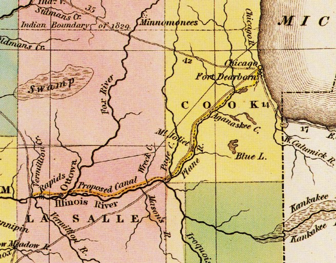
But before one can erect buildings (architecture) in a city, there must be a city. That is, before architects can begin to practice their art, politicians, businessmen, and engineers have to lay the groundwork with a physical infrastructure of streets, sidewalks, water distribution and sewage removal, street lighting, and (in the case of Chicago) bridges. Chicago’s business district surveyed into 64 blocks as initiated by surveyor James Thompson in 1830 started out as primeval prairie marshland(bounded by the lake on the east, the river on the north and the west, and by Van Buren Street, as far north as the city would eventually permit the railroad to penetrate the city’s fabric, on the south). I originally had also toyed with the idea of using the title, “64 Blocks,” as this story is also the history of how Americans during the latter two-thirds of the nineteenth century used these 64 blocks for their own purposes to evolve the urban fabric of streets, sidewalks, buildings, and open spaces for the Euro-American city of over one million residents known as “Chicago,” that by 1900 had become the economic center of the trans-Appalachian western half of the country.
And “used,” with minimum, if any, government intervention, is the operative term for the laissez-faire attitude of Americans towards their government in the nineteenth century. But while this hand’s-off attitude of government’s responsibility applied only to its ability to control what a private citizen could do with “their” property, it by no means applied to what a particular elected representative, or group thereof, could accomplish in the way of graft, patronage, or what was commonly referred during this period as “boodle.” Boodle would be plentiful in Chicago, especially for those who had, to use a particularly Chicago term, “clout.” Free market capitalism was the rule of the day in the nineteenth century, and it applied to private business as much as it did to representative government. Everything had a price, what today we call “commodification,” and no city better than Chicago represented the nineteenth century commodification of everything, for Chicago would even invent the “commodities market.” Anything and everything (including eventually the sky) would be “for sale” in Chicago.
Those 64 blocks of virgin prairie represented the ultimate commodity: free land whose ownership would go to the highest bidder. Thomas Jefferson had planned for the orderly distribution of this commodity (taken, of course from its indigenous inhabitants) in the Land Ordinance of 1785 by applying Rationalism, then the dominant philosophy near the end of the Enlightenment or the “Age of Reason,” to solve the problem: the French philosopher René Descartes’ rectilinear grid was extended over nature’s tabula rasa (a blank slate) of the prairie of the NorthWest (see illustration). Man was, so characteristically for the era, exerting his dominance over nature. Nineteenth century technology would allow him to do this, and nowhere better than in Chicago was this attitude made more manifest. The city’s unofficial motto, “I will,” reflects the city’s tradition that from its founding, has been one of overpowering anything and everything that stood in its way, including nature itself. This attitude had at its foundation, a positivist belief that mankind can overcome nature at any point with the use of its technology.
As we shall see, Chicago was a completely artificial or man-made city, in a location that nature had not necessarily predestined for human habitation, very much like Venice or the Netherlands. This was eventually proved by the fact that the reason for its original existence, a port on Lake Michigan that could be connected to the Mississippi River, was eventually better served with the construction of another port where Chicago should have been built in the first place, at the southern tip of Lake Michigan at the mouth of the Calumet River. While its geographic location at the mouth of the Chicago River that emptied into Lake Michigan made its location “desirable” from a transportation standpoint, these same topographic features made the immediate area relatively unoccupiable. Ground water was so close to the surface that privy holes could not be dug but had to built up from the ground. There was so little elevational slope to the terrain that rain, snowmelt and sewage did not drain anywhere, but simply stayed where it fell. Because the local soil structure included a shallow layer of impervious clay, only so much water could be absorbed before the roads turned into rivers of knee-deep septic mud. As the city began to grow, the municipal authorities responded to the sewage problem by building a system of primitive surface sewers that diverted the city’s sewage to the main branch of the river. Unfortunately, the river flowed into Lake Michigan, the source of the city’s fresh water, where the lake’s current frequently pushed the effluent south, past the city’s first freshwater intake, initiating a vicious and unhealthy cycle that encouraged the mass diseases of cholera and typhoid. The city had little choice but to eventually raise the elevation of the entire downtown, one building at a time, in as much as 15’ in some places, in order to install a viable sewer system above the original ground level with sufficient slope to the river.
To overcome the problem Chicago had in obtaining fresh water, the city first attempted to, and succeeded in building the longest manmade tunnel to date, under the bed of the lake as its freshwater intake, thought to be far enough away from the mouth of the river with the hope that the distance would purify the water. When this proved ineffective in times of heavy rains and spring thaws, the city resorted to the ultimate application of human technology to solve a “natural” problem: it reversed the direction of the flow of the river, itself. Therefore, without the engineering prowess of such men as William Ogden, William McAlpine, Ellis Chesbrough and Octave Chaute, Chicago would have been left in the mud drinking its own sewage for a much longer time than it did. Therefore, there could have been little, if any architecture in Chicago if it hadn’t been for the inventiveness of the city’s engineers. While the city celebrates its long history of architects, Chicago’s great engineers are the city’s unsung heroes and merit having their story told along side that of its architects.
A city also must have an economic infrastructure in place not only to generate the funds to pay for these civic necessities but also to be able to build architecture, because it is, after all, one of the more complex (politics) and the most expensive (money) of the arts undertaken by humans. With architecture we are immediately confronted with the reality that it takes a minimum of three people to design and build a building (with the exception, of course, of an architect’s own house): the architect and the person who will pay both the architect to design the building and the contractor to erect the building. This is not necessarily the case with a poem that can be written by a single person, or with a painting by an artist who can purchase a canvas and apply paint to it without any direction or resources from anyone else, or a musical composition written by a person who can sit down at a piano’s keyboard and compose a piano sonata. These activities can all be done by a lone individual, who, once finished, can leave the finished work for posterity to do with it as it may please.
Not so with an architect. While he or she can sit at his board (or now computer) and draw a building just as easily as the painter can do a painting, the result is not a piece of architecture: it is a drawing, but it is not, by any means, a building. For a drawing to become architecture, a real physical object that people can look at, touch, and walk through, it must be made into a three-dimensional object, a building. And of course, this costs a great deal of money that someone must provide. The infant town of Chicago needed men of great vision and business acumen to create a viable urban economy that eventually could embark on the creation of architecture, and to have a strong urban economy in the nineteenth century, an American city had to know how to “play to win” in the national political arena. Two of the most important political contests during this period in American politics that would be central to the “I will” city’s ascension as the largest and most powerful city in the West would be the route of the first transcontinental railroad and the Civil War.
(If you have any questions or suggestions, please feel free to eMail me at: thearchitectureprofessor@gmail.com)
